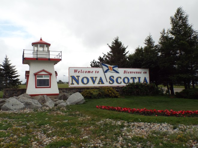
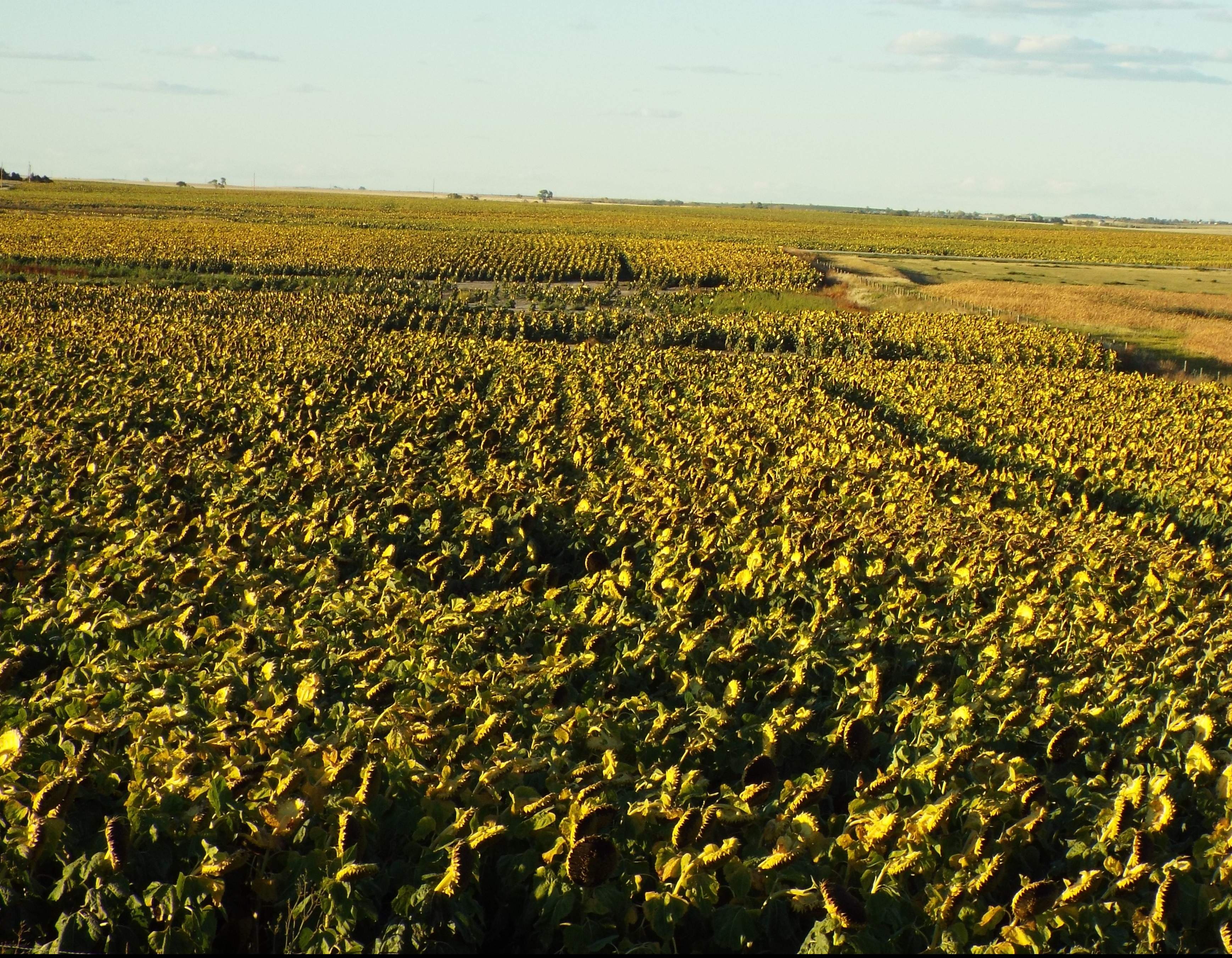
It’s not every day the Gnome and I plan an overnight stop just an hour from the previous night’s lodging, but that’s just what we did on much of our Nova Scotia journey. It’s a good thing we did, because a one-hour drive anywhere else easily turns into an eight-hour adventure of the senses in this maritime province, especially when you decide to take the slowest, most scenic route, traveling out to this cove and that one, and stopping at every photographic opportunity you see. That’s approximately one per minute along the South Shore of Nova Scotia!
We had already made a sunrise visit to tiny, picturesque Peggy’s Cove on one of our Halifax days. Peggy’s Cove was one of our most delicious memories from our first visit forty-nine years ago, even though we were shrouded in fog. We could barely wait to see it again. It did not disappoint.


Our destination today was Lunenburg, stopping at the villages of Chester and Mahone Bay along the way. Chester’s waterfront is nothing less than stunning. (Click on images for a larger view.)


The village sports a small park with a couple of stirring war memorials. One features a Nova Scotia Highlander atop a monument honoring the 54 area soldiers killed during World War I. The other is a thank you from Norway. During World War II, more than 1,000 Norwegian merchant ships were at sea when Nazi Germany invaded the country. The ships sailed to the nearest allied ports. Thus, Chester’s Hackmatrack Inn became a convalescent center for the sick and injured Norwegian seamen who headed for safe harbor in Nova Scotia.


We wanted to stop in Mahone Bay to see its photogenic ‘Three Churches.’ Though we never found the best spot to photograph them, we still enjoyed their beauty—along with three or four tour busloads of other folks. 
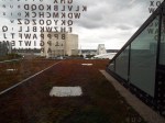
Quite by accident, we happened upon other visual entertainment, as well. The village was preparing for its annual Scarecrow Festival, which was set to begin in five days. Everybody gets in on the act from families to churches to dentists. (Look closely—can you see the braces on the dentist’s patient, bottom right. These characters were, of course, in front of a dentist’s office.)


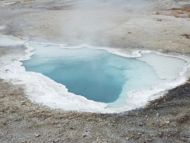
We discovered a small nearby beach for a picnic lunch where a couple of folks from the area recreation department had set up shop encouraging residents to visit this little-known treasure. (Nova Scotia has few sand beaches, but this is one of them—sort of.) 
They invited us to fill a jar with sand and shells as a memento of our trip. And here is where we found, as we did over and over, the very best thing about the province—its people. They asked where we were from, commiserated over Hurricane Florence (which was on every Nova Scotian’s mind), found out where we were headed, and filled our heads full of not-to-be-missed places to visit on our journey. It was great fun meeting them.
Next on our agenda was Blue Rocks, Lunenburg’s ‘answer to Peggy’s Cove,’ even tinier and just as much off the beaten path. 


Downtown Blue Rocks
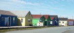
And, finally, just around suppertime, we made it to Lunenburg, whose Old Town is a UNESCO World Heritage Site as the best surviving example of a planned British colonial settlement in North America. In spite of its tourist appeal, this fishing village has managed to retain its authenticity since its founding more than 250 years ago. Quite a feat.

Lunenburg streetscape

Old Town Lunenburg’s buildings are not reproductions. These are the real deal.

Detail, detail, detail!

A 1870s shipbuilder’s home

Nova Scotians sometimes refer to themselves as Bluenosers and here’s their proud reason why, I’m told: the Bluenose schooner, launched in 1921, raced undefeated in international competitions for 17 years. The Bluenose II, a faithful replica, was born and lives in Lunenburg just like her predecessor.

Complete with passengers
Just as we expected, our ‘one-hour’ trip turned into a long and busy day, and we were definitely ready for an early bedtime before the next day’s activities. Stop by next week to see what we discovered next.


 but not before sitting on the deck with a glass of ginger wine and wrapped in quilts (there was a real brr factor that evening) to watch the sun set across the bay.


 We stayed just outside of Taos in another airbnb, appropriately enough a casita. It would have been an ideal place to chill out for a few days with a good book and a few glasses of our favorite beverage had we not wanted to see what Taos had to offer.
 Courtesy of our airbnb host, we were in for another bit of serendipity (by this time, we were almost expecting such moments)—the Rio Grande River and Gorge. We had no idea the Rio Grande was this far north. It was an awesome sight.
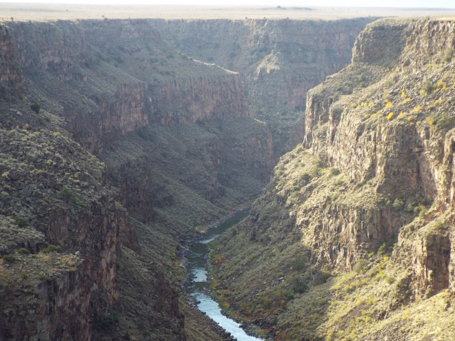


 As we left Cadillac Ranch, we decided to travel a few miles farther on Route 66. For the most part desolated and decaying, it still has a few unexpected treats, one of which is the Devil’s Rope Museum in McLean, TX.
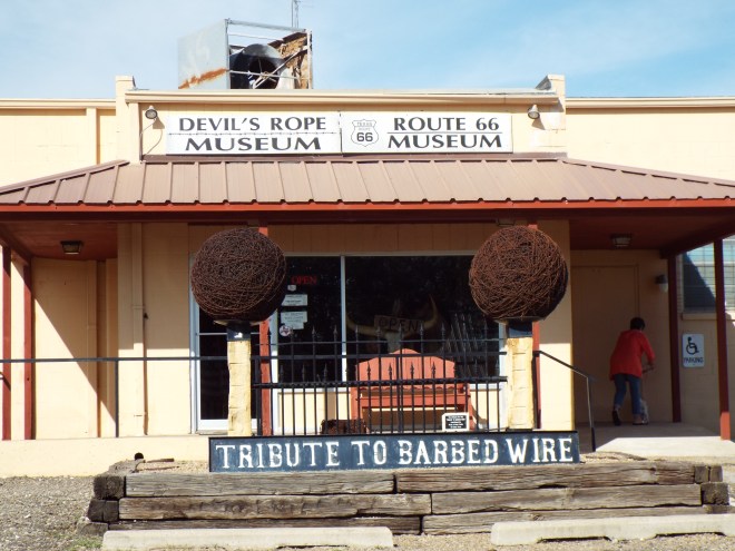 We had a little time; we decided to stop. As we walked up the steps, a woman leaving looked at us and said, “It’s surprisingly interesting.” She was right. The museum (free, by the way) features collections from barbed wire collectors (yes, that’s a thing all across the country, as well as everything related to barbed wire—tools, salesman samples, sculpture, and a library filled with patent information.


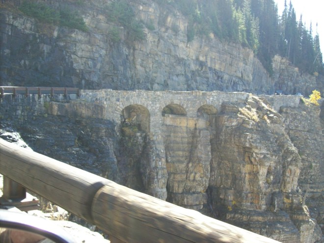
 The canyon with its high rock walls, rapidly flowing river, and railroad running on a narrow ledge between the river and the canyon wall caught us completely off guard. And it became one of the two biggest highlights (other than family, of course) of our entire trip. All in thirty-four miles. They say you can drive it in forty minutes if you don’t stop. But of course we did. We wanted to savor it—both the scenery and the sheer awesomeness of the experience.
 Douglas is full of history. Established in 1867 when Fort Fetterman was built just ten miles away, named for Stephen A. Douglas (Lincoln’s presidential opponent), a World War II prisoner of war camp that held 5,000 German and Italian soldiers, and home to both the Wyoming Pioneer Memorial Museum and the Wyoming State Fair.
 Our Douglas lodging was the charming Hotel LaBonte, currently on the National Register of Historic Places. It’s hard not to let your imagination run wild when you stand in the lobby. The place reeks of ranchers, cattle barons, and railroad tycoons.
 Just as it was closing time, we dropped in on what may be the world’s friendliest Chamber of Commerce where the helpful staff told us about what turned out to be the other biggest highlight of our trip: the Oregon Trail Ruts and Register Cliff, part of the Oregon National Historic Trail. We’d been planning on turning in early, but it didn’t take a nanosecond for us to change our plans and take off for Guernsey, just twenty miles away.
 Just a couple of miles away is a place called Register Cliff. Think of it as a pioneer version of a hotel and its accompanying ledger. The sandstone cliff, in those times a day’s journey from their previous night’s stay at Fort Laramie, provided some degree of shelter as well as a place where people could chisel their names and date of arrival. Maybe it was a message to relatives and friends coming in a later caravan. Or maybe it was a way of recording for the ages, “Look, I made it this far!”
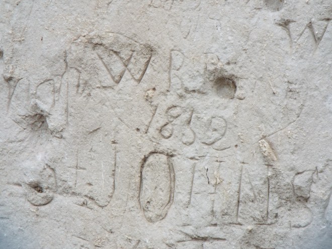

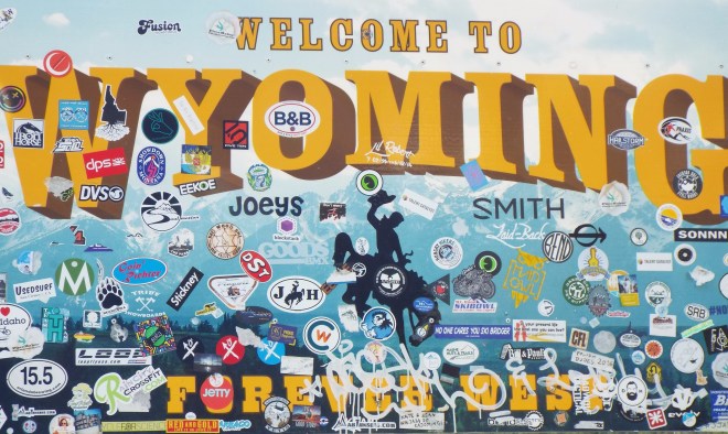
 Wyoming, you stirred my soul and stole my heart.


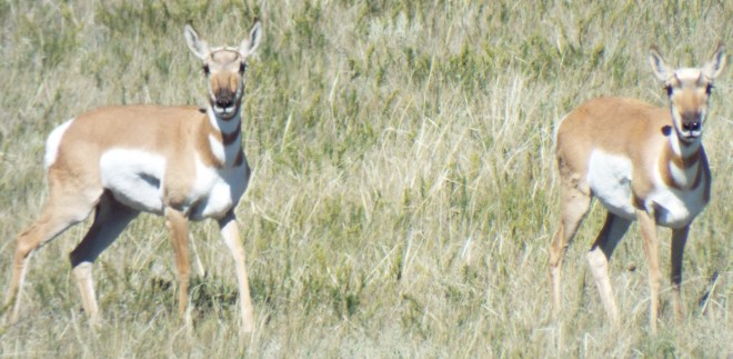
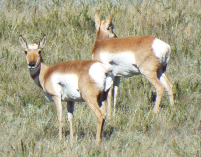
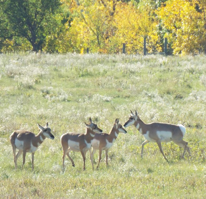
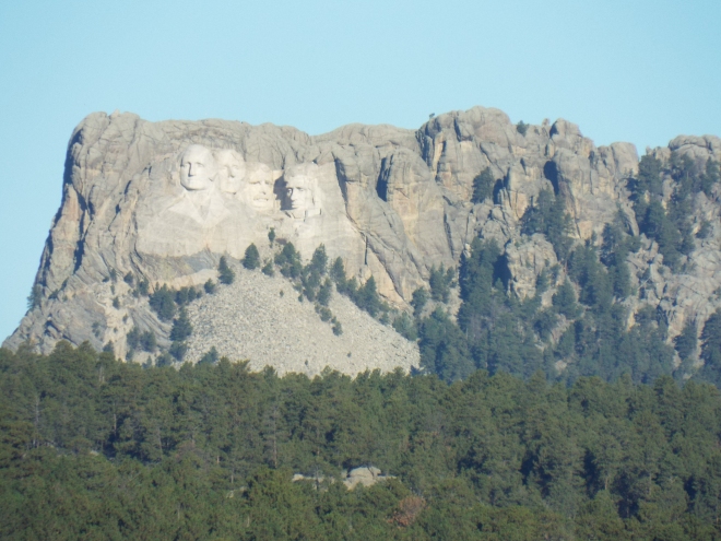
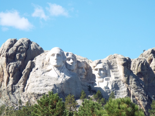
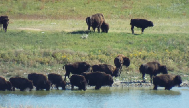
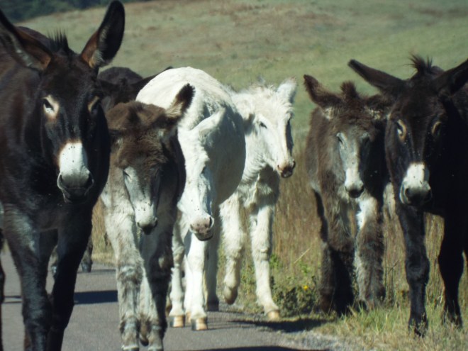
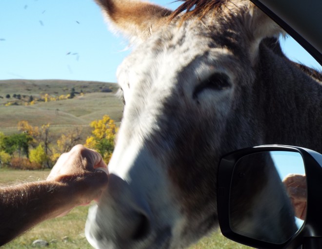
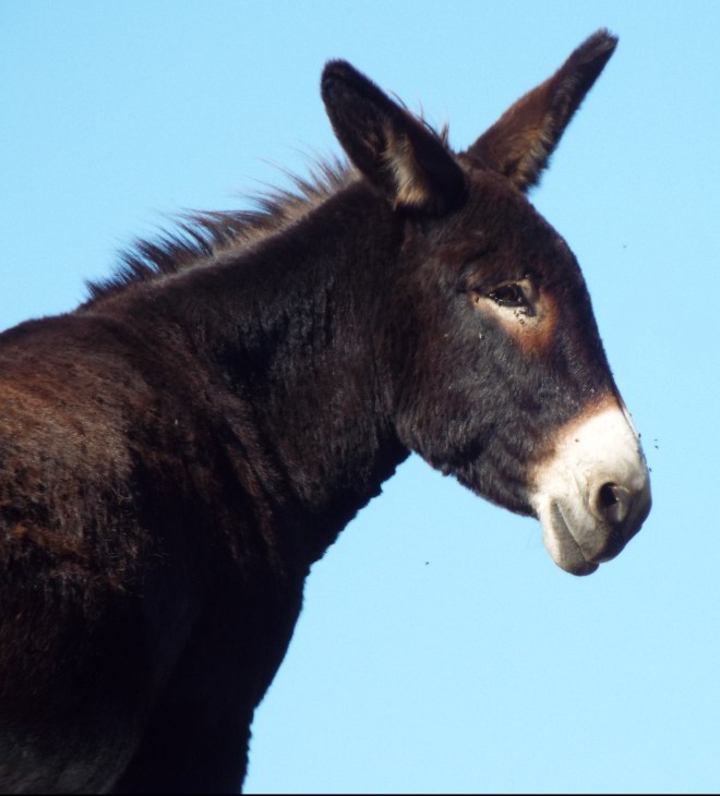
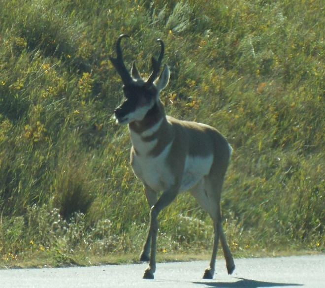 We really didn’t know what to expect in the Black Hills, other than that we’d see Mount Rushmore and hopefully a few bison or other wildlife blocking our path somewhere or other. Were we ever in for a treat! Driving the Loop Road in Custer State Park, not only did we get close-up (as close as is safe) views of the bison; we got real up close and personal with some pretty brazen donkeys.

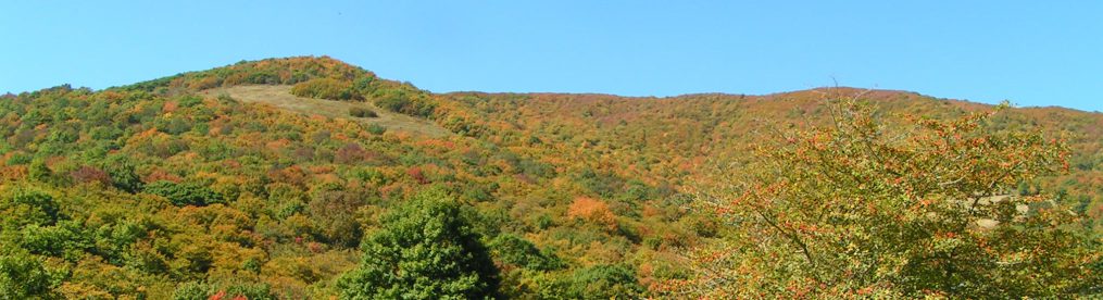
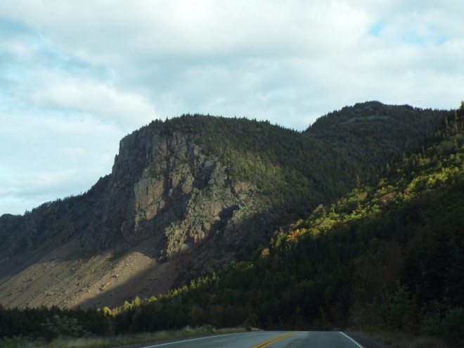
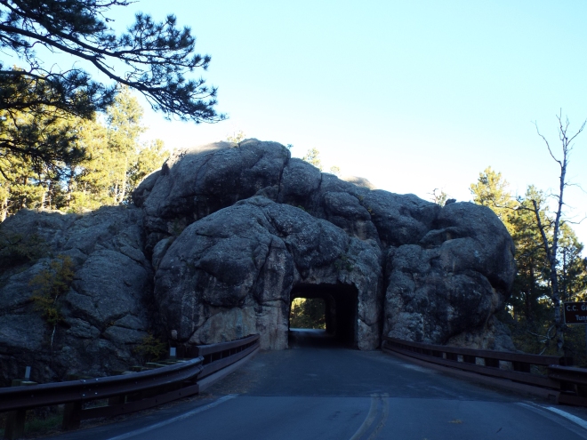
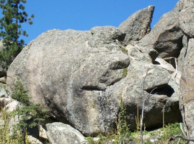
 It was the many unusual and massive rock formations, though, that captured our imagination. Sort of like finding cloud pictures in the sky. We’re definitely returning for a longer stay, probably right smack in Custer State Park. What do you see in these images?


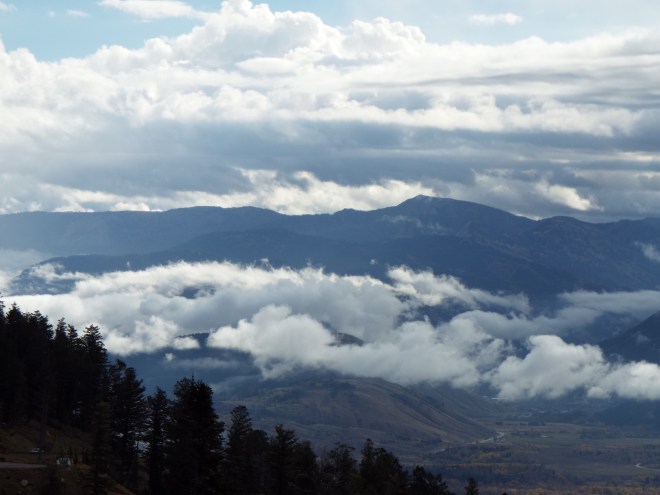
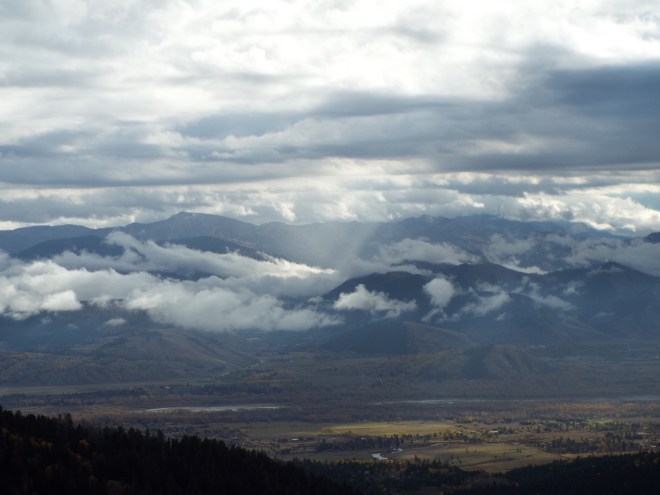
 Leaving our final “cousin destination” in western Montana, we opted for a more southerly route home so we could see more new-to-us parts of the country—a very good idea, it turned out. One of the many unexpected and spectacular sights we encountered was Mt. Borah. Located in the Challis National Forest in eastern Custer County, Mt. Borah is Idaho’s highest mountain. Though it was only rainy down where we were, way up at 12, 667 feet above sea level, snow was beginning to cover the peaks.
 We stopped to learn about the 6.9 magnitude earthquake that shook the mountain in 1983, raising the peak about a foot and lowering the valley floor by eight feet. We could even see the quake’s scar on the side of the mountain. (All very intriguing, but absolutely as close as I ever want to get to an earthquake!)

