Joggins and Home

(The end of this reprise of our 2018 trip to Nova Scotia comes to a close with this post. But stay tuned for a couple of extras coming soon. To ‘travel’ virtually with us from the beginning, click here.)

Bittersweet is the best that can be said for what was to be our last day in Nova Scotia. To ensure as much time as possible in Cape Breton, we had planned this to be a long travel day. It would take us practically to the border with New Brunswick, in the tiny rural community of Joggins. So tiny that AAA couldn’t find it to map out this portion of our trip. So tiny even a number of Nova Scotians didn’t recognize the name. Yet Joggins is home to yet another UNESCO World Heritage site. The Joggins Fossil Cliffs contain the most complete fossil record of life during the Coal Age, 300 million years ago. That’s a full hundred million years before the dinosaurs, so these fossils, preserved in the very place they lived, are the dinosaurs’ ancestors. Some of the fossils found here are giant insects. According to the Joggins Fossil Cliffs website, this is the only place on earth where you can view these rare plant and animal fossils in situ. Well, I was impressed! 

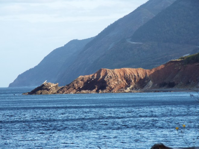
The tide is out at Joggins Fossil Cliffs. It will rise by an astounding 43 feet at high tide, cutting off access to the beach area.

See the tiny person in the middle foreground. You must walk down many, many steps from the top of the cliffs to reach the beach, something like 75, as I recall. That’s about six or seven stories! But we did it.
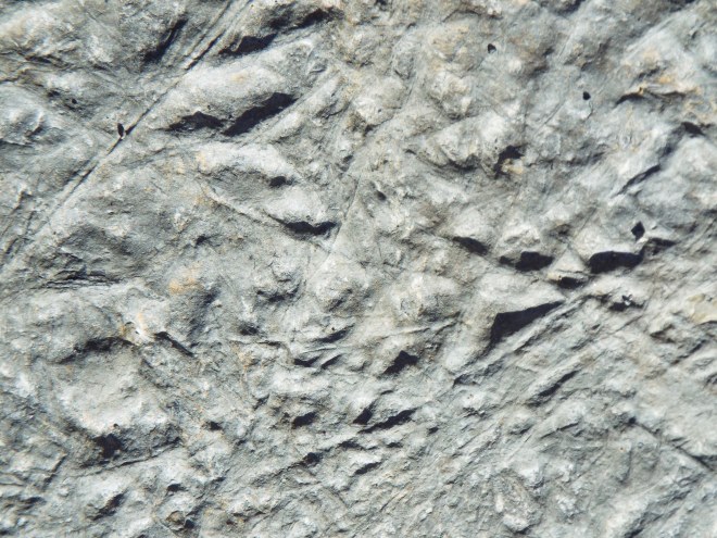
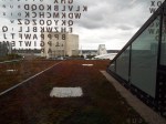
Giant insect?

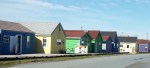
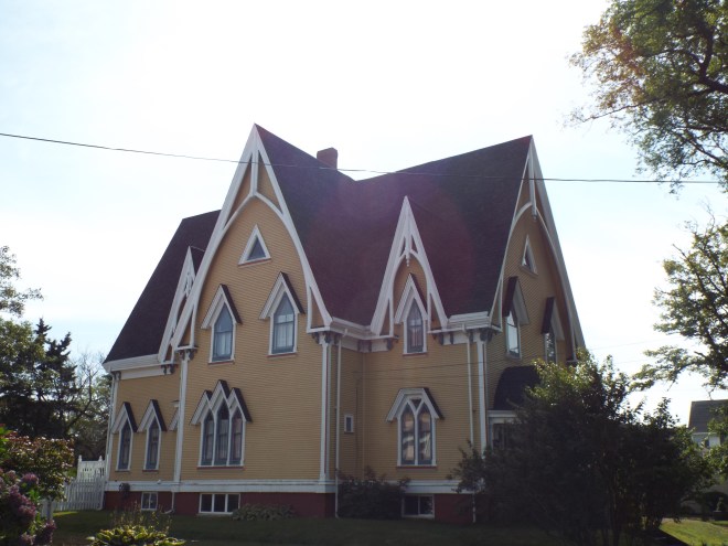
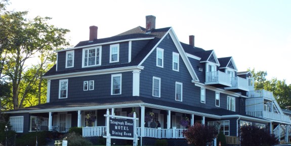
We stayed the night at a true bed and breakfast inn, though we’d found it through Airbnb. We were joined by a young couple driving from Halifax to be with family for Canada’s Thanksgiving weekend. The four of us enjoyed a visit in the living room where we shared our respective’ backgrounds and learned a bit about cultural similarities and differences while enjoying some of our host’s homemade wine. Not only does Bridget own and run the B&B and make wine, but she’s also begun a business manufacturing buckwheat pillows—and she’s a former international professional singer, besides. (And her breakfast was fabulous!)

Crab Apple Inn, Joggins, Nova Scotia

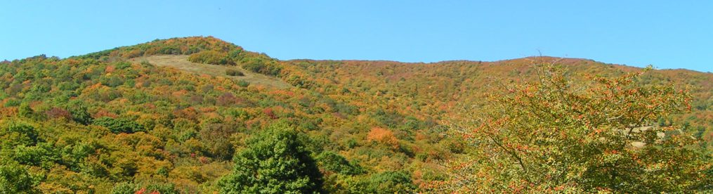
The next day saw us driving across New Brunswick and into Maine. Though the leaves had only just begun changing color in Nova Scotia, they were really showing off in New Brunswick.

Not be the sharpest photos ever taken, but hey . . .

we were going 110! (in kilometers, of course)

Crossing the border back into the States was harrowing—at least the waiting was. We’d read that we needed to itemize all our purchases and have them and all receipts readily available for inspection, so we’d spent a long couple of evenings getting our documentation and souvenirs organized. Though we’d practically sailed into Canada (no lines and only a single benign question by the border agent), we waited here for close to forty-five minutes. Plenty of time for us to begin feeling guilty for merely imagined offenses. Cameras were watching from every angle. We tried to look innocent and nonchalant. Did that make us look like crooks instead? Our unease only increased when the border patrol unlocked and entered the RV in line in front of us.

Finally, it was our turn. We were asked the nature of our visit, if we’d enjoyed our stay, and whether we’d purchased anything other than souvenirs, personal gifts, and incidentals. That was it. A lot of worry for nothing.

In Maine, we made a little detour to stay in Seal Harbor, right at an entrance to Acadia National Park, a place I’ve always yearned to visit. Was it exhaustion as we were nearing the end of our travels? Was it being surrounded by so many leaf-peekers and their vehicles after so much Nova Scotia tranquility? Whatever the reason, we were underwhelmed. It was the only disappointment of our twenty-five-day journey, but it was about to be made up for in a big way!

We made one last detour before the big push to get home. When we’d come across an Airbnb listing in the small village of Newbury, Vermont, we added a day to our itinerary just so we could take it in. Everything about our host, her home, her village seemed so iconically New England.

And so it turned out to be. The home we stayed in is almost two hundred years old on a street of similarly aged residences, mostly modest clapboard homes with gabled fronts. Most of the village’s structures were built either between 1790 and 1860 or in the ten years following a devastating fire in 1913.

Not every residential neighborhood is on a town’s Main Street, which, in this case, is also Vermont Highway 5. Never was there a quieter thoroughfare. Between the residences is the core of the village, the Village Common, a large green space for public use. The village hall, village school, and Methodist Church sit on one edge of the Common. The entire village, flanked by the Connecticut River, is a historic district.

Simply idyllic. Just our style.

Linda, our host, is a professional photographer. She works in black and white, uses old cameras with actual film, and has her own darkroom. Like the Gnome, she collects cameras. (I told her she should count them before we left–wink, wink.)

She was kind enough to take us on a walking tour of her charming village the next morning. We passed the Village Common, the school, the church, the post office, the village hall, the public library. We stopped for chats with other morning strollers. We talked about the village’s history and Vermont’s fabled town meetings. We took in the village store (the oldest country store in Vermont) for a steaming cup of coffee and yummy homemade cinnamon rolls, then sat on the steps to chow down. We dropped in at the bank to study old black and white pictures of the fire.

The bank is closed on Saturdays, but our host has a key. (It seems that the few villagers who lock their doors share their keys with the neighbors.) Linda loves her hometown and its history, and it shows.

Unfortunately, sometime between our return home and getting to this point in my travel diary, the last two hundred or so photos mysteriously disappeared from our camera. I had to resort to Google to find a couple of photos to share. 

Newbury Village Store. Photo credit: redjar [CC BY-SA 2.0 (https://creativecommons.org/licenses/by-sa/2.0)%5D, via Wikimedia Commons


Tenney Public Library, Newbury Village, VT. Photo credit: Magicpiano [CC BY-SA 3.0 (https://creativecommons.org/licenses/by-sa/3.0)%5D, from Wikimedia Commons

Newbury Village UCC Church. Photo credit: wikimedia.org/wikipedia/commons/5/56/NewburyVT_UCCChurch.jpg

Just because our travels are over, don’t think I’m through writing about Nova Scotia, There are still a couple of reflective posts (and, of course, photos), so I hope you’ll come back to see what they are.

Cabot Trail, Part II

(While we’re all busy keeping safe by staying home, you might like to join me on a recap of my 2018 road trip with The Gnome to Nova Scotia.  This week, we’re on the second leg of the breathtaking Cabot Trail in Cape Breton. and I recently took a long (and long-awaited) road trip throughout Nova Scotia. To read about—and see—it from the beginning, click here.)

It was almost mid-afternoon on our trek around the Cabot Trail when we stepped into a small museum near Dingwall (on the northern edge of Cape Breton Highlands National Park) for a much-needed bathroom break. A couple of (very) young women from New Zealand had the same idea. (Amazing how you meet people from all over the world on the trail!) They were cycling the trail from the opposite direction. While we were going downhill, they’d been climbing all day, since dawn, in the chilly rain. How I felt for them!

I had to chuckle at the sign on the inside of the bathroom door. It said something to the effect of, “We get it. You really need to go,” and welcomed folks to use the amenities (they are few and far between on the trail), but it also asked for a donation if you planned to skip the museum itself. Fair enough! We decided to take it in, though. It was surprisingly professional and enlightening, especially for such a tiny place. There’s even an area for genealogical research.

We saw lots of informational exhibits like this one at the North Highlands Community Museum which explains why all the island’s small communities are so tightknit. Note how doctors made house calls well into the mid-20th century!

Oh, my! I sat at a desk like these in my rural elementary school.

The pleasant woman staffing the museum told us she thought the part of the trail still ahead of us was its prettiest section. That was hard to believe, given the vistas of our previous two days. Turned out she was right, though the day was so stormy it wasn’t such a good picture-taking day. We decided to come back for more the next day, which was less rainy, but extraordinarily windy and often almost as hazy. Still, we took lots of photos. (You knew we would!) 

We took a few damp hikes, including the bog walk at which, if we’d been there a few hours earlier, we’d have surely seen moose—we sure saw lots of tracks. We also hiked the short trail to this Scottish Highland shieling, a hut to shelter crofters (farmers) and their livestock from the brutal weather on the moutaintops. And we hiked enough of the Skyline Trail to see . . .

this! After 49 years’ worth of trips searching in vain, we were able to prove to ourselves once and for all that moose are not the mythical creatures we’d begun to believe them to be.

From the road far below, you can see folks that made it to the end of the Skyline Trail, at least with binoculars—or a telephoto lens.

Photos of the curvy, coast-hugging Cabot Trail, where the mountains kiss the sea.

Our destination was Chéticamp. Little did we know that on one of our look-off stops, our camera had captured an image of the home where we’d be spending the next couple of nights.DSCF5596 
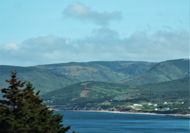
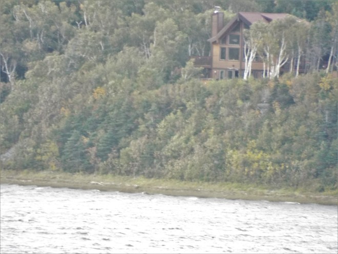
Our charmed, and charming, hosts had found themselves one of the most perfect places on earth to live. Not only is their home on the edge of the Chéticamp River (which they often kayak, lucky ducks!), but on the opposite side of the river is the majestic park itself. From their huge living room windows, they can also see where the river empties into the Atlantic Ocean. Where else could you get that kind of view? It was a good way to end our trip around the park.

The view from the living room window includes this mountainous cliff, part of Cape Breton Highlands National Park.

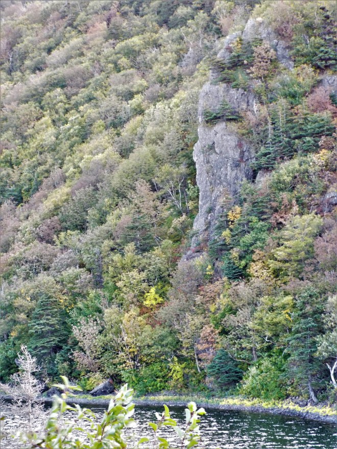
This spit of land is all that separates the river from the ocean, also seen from our hosts’ living room window. How cool is that?!

Come back for the last days of our travel adventure and some more reflections, won’t you?

The Cabot Trail, Part I

((I’m reposting a travel series from a couple of years ago. If you’re like me, you are patiently (or maybe not so patiently) waiting for a safe return to the road. If so, how about traveling along with me on a virtual road trip. To read about our Nova Scotia travels from the beginning, start here.)

When it comes to the Cabot Trail, the winding road that hugs the coastline in Cape Breton, much of it in Cape Breton Highlands National Park, words are a waste. Let’s just look at some pictures!

seal island bridge, sydney river

We crossed the Sydney River by way of the Seal Island Bridge (vantage point: atop Kelly’s Mountain) to reach the Cabot Trail.

Someday I want to go here to see if I can learn Gaelic. Really, I do.

The sky was angry and so was the sea! Can you see a bit of the white house hiding behind that huge spray of water in the lower right photo? (Click on individual photos for larger view.)

Cabot Trail: Anglican ChurchA stand of birch, an Anglican church, and a workshop adorned with moose antlers

DSCF5295

Scenes from Neil’s Harbour (I believe).

Meat Cove: much prettier than it sounds. You reach this beautiful spot after a very long (30 minutes or so) drive on a rutted dirt road (only to return the same way). Not much more than a campground (see the little cottages in the foreground of the bottom picture?), it’s worth the drive. They say that on a clear day you can see Newfoundland from this northernmost Nova Scotia community. We weren’t there on a clear day.

Check out all those balancing rock cairns on the rocky beach far below us at Meat Cove.

Why, yes, you can find sand on Nova Scotia’s beaches! (A wee bit, anyway.)

Freshwater Lake, Ingonish Beach

cabot trail shore
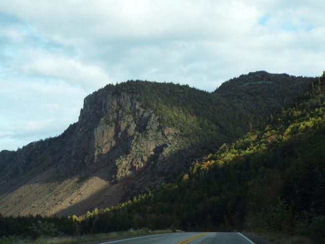
Just some pretty Cabot Trail views, even on a rainy, foggy, hazy day

Stay tuned for more on Cape Breton’s Cabot Trail.

Nova Scotia’s Eastern Shore and More

(I’m reposting a travel series from a couple of years ago. If you’re like me, you are patiently (or maybe not so patiently) waiting for a safe return to the road. If so, how about traveling along with me on a virtual road trip. To read about our Nova Scotia travels from the beginning, start here.)

From Wolfville, we headed for Cape Breton Island by way of Nova Scotia’s Eastern Shore. The province is divided into seven geographical regions, and this one may be the least well-known. It’s surely the least visited by outsiders and maybe even other Nova Scotians. There are no towns to speak of, only communities—and small ones at that. Places with names like Ecum Secum. According to Wikipedia, the name comes from the M′ikmaq (aka Mi′kmaw) language and means ‘a red house,’ which suggests to me that may be about all that was there at the time. The nearest town of any size is Antigonish on the west coast, 45 miles away, with a population of 4,200.

As usual, we drove as close to the coast as we could get, this time on Trunk 7, also known as Marine Drive. Our Airbnb stop for the night was at Moser River, in what was billed as a former prospector’s cottage. It was an instant hit, and Gail, our Airbnb host, was simply delightful. (More about her in a future post.)

Our Moser River prospector’s cottage Airbnb and area images. (Click on individual photos for larger view.)

We were advised to stop for food or gas in the community of Sheet’s Harbor, about 30 miles away—that’s how unpopulated this place is. People here are mostly connected to either the fishing or gold mining industry.

The Eastern Shore is not a place to go if you depend on theme park style extravaganzas for entertainment (though if you time it right you can join in a sand sculpture competition, a parade, a cakewalk, or a Celtic jam session). But if you want a little solitude away from everyday hassles, it’s perfect. I can imagine hanging out here for a long weekend with a hammock and a good book or hiking boots and a walking stick. It’s the perfect retreat stop—as long as you bring your own meals. Unfortunately, we had only one night at this peaceful place.

And the next day we finally made it to the place that had held onto our hearts for so many decades, Cape Breton Island. We would be here for six days instead of the one of so long ago. It would still be too little.

But first, we made a little detour to the opposite side of the province. We kept having to remind ourselves how short a drive it is from one side to the other. This side trip was to Cape George, near the town of Antigonish. It was well worth the drive.

Our first Cape Breton stop was the town of Baddeck (pronounced Buh-DECK). We stayed at the historic Victorian-style Telegraph House, built in 1861, one of the few non-Airbnb places we stayed during our travels. At one time, the Telegraph Inn contained the office of the first Trans-Oceanic Cable Company. Some of the first telegraph messages in North America emanated from here.

Baddeck is famous for two things. It’s home to the Bras d’Or Lake (arm of gold), actually an inland sea. It’s roughly sixty miles long and thirty miles wide. Pretty darned big. And beautiful, surrounded as it is by low mountains. We could never get a photo that came near to doing it justice.

Baddeck is also where Mabel and Alexander Graham Bell lived for the latter half of their lives. It was here that Bell established a research laboratory—the first Bell Labs. He used the lake to test his huge kites, hydrofoil boats, and airplanes, just a few of his varied research projects.

Of course, there’s a museum, and since the Gnome is interested in anything having to do with inventiveness, we had to go.

Married as I am to someone who observes every little thing, I was especially drawn to this quote memorialized in the museum.

I was impressed to learn that Bell was much more interested in his work teaching deaf students (Mabel was deaf), and later with aviation, than with his best-known invention, the telephone. In fact, he was rarely interested in following through with any of his inventions after the initial creation; he was ready to move on to the next thing, leaving the details to others.

The highlight of our time in Baddeck had to be finding a ceilidh (KAY-lee), or kitchen party, where we got to listen to some lively traditional Cape Breton tunes by fiddler Mike Hall. Mike didn’t just play; he talked about the history of the music and how the Scottish Highlanders who were driven from their homelands with no instruments or written music managed to keep their musical tradition alive and true to its roots. It was mesmerizing—and quite different from the bluegrass jams we attend at home.

Cape Breton is where you might hear not only English and French, but also Gaelic and Mi′kmaq, an Algonquin language. It was fascinating to see multi-lingual signs everywhere. Appropriately, top billing usually matched the primary culture and language of a given area, as far as I could tell. Here’s a little Gaelic for you: Fàilte gu Cridhe Gàidhealach Albainn Ùr.  (Don’t bother trying to pronounce it—it sounds nothing like you’d think if English is your primary language.) As best I can determine, it translates to “welcome to the heart of New Highland Scotland.”

We left Baddeck by way of Iona, traveling ever so briefly on a cable ferry to Grand Narrows, then on to Sydney and the Cabot Trail, the subject of my next blog post.

Here comes the ferry. Short crossing—very short.

(Check back next week for more of our Nova Scotia travels as we head to the famed Cabot Trail and Cape Breton Highlands National Park.)

A Couple of Nova Scotia’s Historical Sites

(I’m reposting a travel series from a couple of years ago. If you’re like me, you are patiently (or maybe not so patiently) waiting for a safe return to the road. If so, how about traveling along with me on a virtual road trip. To read about our Nova Scotia travels from the beginning, start here.)

In previous posts about our visit to Nova Scotia, I’ve mentioned a couple of sites that deeply moved me, promising to delve into them later. Today, I’m keeping that promise with memories and photos of our visits to Grand Pre, a UNESCO World Heritage Site, and the Canadian Museum of Immigration.

A little history is called for here. The Canadian encyclopedia entry about the Acadians of Grand Pré begins this way: “Soldiers rounding up terrified civilians, expelling them from their land, burning their homes and crops ‒ it sounds like a 20th century nightmare in one of the world’s trouble spots, but it describes a scene from Canada’s early history, the Deportation of the Acadians.” The story of the expulsion of Acadians from Grand Pré is painfully evocative of our own Trail of Tears history, when the Cherokee were led on a forced march from the east to Oklahoma.

In French, the forced deportation was known as le grand dérangement. Sounds fitting. Since 1604, Acadians had created a thriving, peaceful community in the Bay of Fundy area. During their 150 years here, they developed an impressive dyke system to control the bay’s high tides, a method still in use today; they developed and maintained a rich agriculture; they created a massive and gorgeous landscape

The arduous task of building earthen dykes to hold back the Bay of Fundy’s high tides

A  typical Acadian farmstead

An image of  an Acadian day in the fields

A portion of the 3200-acre landscape of Grand Pre’

Meanwhile, the British and French were engaged in a long tug of war over Nova Scotia. The Acadians had sworn neutrality in any conflict between the two countries, but that wasn’t enough for the British governor. In 1755, he hatched a plan to surround their churches, threatening entire families with bayonets, while breaching the dykes and burning homes and crops. The first 3,000 deportees were sent to Pennsylvania, South Carolina, and Georgia while 7,000 more were shipped to other British colonies, France, and the Caribbean during the next seven years.

Try putting your family in this scene:  panicked flight, trying to stay together, leaving everything–everything–behind forever.

People found themselves left, like Longfellow’s Evangeline, to wander fruitlessly in search of the families they’d been separated from. That, too, sounds all too familiar in today’s troubled times. (Only later did Acadians find their way to Louisiana because of their familiarity with the language. Thus did the Cajun culture become established.)

Detail of the statue of Henry Wadsworth Longfellow’s heroine, Evangeline. It graces the entrance to the memorial church built in the early 20th century which serves as a museum today. It was a church at this approximate location where British soldiers set up headquarters, rounded up the village’s men and boys, and told them their land, livestock, and almost everything they owned were to be forfeited to the Crown, and that their families were to be deported.

By 1764, the British government allowed small groups of Acadians to return, but they didn’t return to their former lands—nothing was left for them there. Instead, those who returned settled on the mainland and in Cape Breton. It was, indeed, as the Acadian Shores restaurant patron we overheard had said, a shameful moment in Nova Scotia’s history.

But Nova Scotia can at least be proud of how it owns up to inglorious historical moments. I was impressed by this trait both here and at the Canadian Museum of Immigration, located in Halifax.

Even before you pay your admission fee to the immigration museum, the Wheel of Conscience almost smacks you in the face with its raw power. A circular steel structure about six feet in diameter, the wheel includes names of the approximately one thousand Jews who were aboard the MS St. Louis in May 1939, the eve of World War II. They were fleeing Nazi Germany, seeking and being refused entry into Canada and other countries, including the United States. With nowhere to go, the ship was forced to return to Germany where a quarter of its passengers ultimately died in concentration camps. 

 The kinetic sculpture also features four rotating, interlocking gears, each one larger than the one before and each emblazoned in red with a single word—from smallest to largest: hatred, racism, xenophobia, anti-Semitism. As visitors study the sculpture, they can’t help but see their own reflected faces looking back at them.

Inside, the exhibits are equally powerful. The museum is located in the very place, Halifax’s Pier 21, where more than a million immigrants came into Canada between 1928 and 1971. It’s logical that the museum would tell what that experience was like.

But the museum is more than that. It also tells the story of 400 years of immigration to Canada, and it takes an even broader approach, looking at refugee life as a whole, documenting through both visual and oral exhibits the horrors that force people to leave their home countries.

What horrific conditions would cause you to make this kind of journey? For how long? To what unknown future?

Imagine living in a tent this size with your entire family and all your very limited possessions, buckets for washing yourselves, your food, your dishes, and more. Imagine living here for up to eighteen years–or more? What would have brought you here?

Some of these painful exhibits come with a warning: “Not suitable for some visitors.” I tend to shy away from such stories, but I think we should force ourselves to face them so we can remember—cannot forget—the realities that send people fleeing all they know in hopes of finding a better life, a safer place, for their families. I did not photograph them.

Among other displays we visited were life-size replicas of a ship’s cabin, a life raft meant for eight that carried as many as thirty refugees, a child’s trunk, a family’s crate carrying everything they could cram in.

You can read notes handwritten on cardboard luggage tags from previous museum visitors who had immigrated, and you can watch videos of immigrants telling their personal stories. As moving as these exhibits are, what touched me most was finding myself in the company of a number of immigration ‘veterans,’ individuals who had landed at the immigration center in Halifax—at this very site when they were mere children. Other visitors were children of immigrants who had come through the port of Halifax. It was truly humbling to hear their stories, to be in their presence.

We didn’t want our visit to Nova Scotia to be touristy; we didn’t intend to spend much time inside museums. Our trip was meant to be about getting a feel for day-to-day life in the province and getting to know real-life Bluenosers while soaking in the phenomenal natural beauty of this place. But I’m really glad we took time out to visit these two sites. They, too, tell a story about the real Nova Scotia. And the rest of the world, in the past and, unfortunately, the present. They remind us about ‘man’s inhumanity to man’ as well as hope and the possibility of redemption.

This moving piece of public art, “The Emigrant,” near the Immigration Museum, pays tribute to those who have said goodbye to their families, hopefully temporarily, in search of a better life for all of them.

(Check back next time for more of our Nova Scotia travels.)

Annapolis Valley

((I’m reposting a travel series from a couple of years ago. If you’re like me, you are patiently (or maybe not so patiently) waiting for a safe return to the road. If so, how about traveling along with me on a virtual road trip. To read about our Nova Scotia travels from the beginning, start here.)

We weren’t even going to go. We’d been to this region long ago, and compared to the spell Peggy’s Cove and Cape Breton had cast, it was a mere wisp of a memory. But then Haligonian gardening guru Niki Jabbour said, “You simply must see our gorgeous Annapolis Valley” (or words to that effect). She’s a convincing ambassador for her maritime corner of the world, so we spent a few hours rearranging our itinerary. Another decision I’m glad we made. Thanks, Niki.

The Gnome and I scheduled a couple of days in the Annapolis Royal/Granville Ferry area and another in Canning and Wolfville. We spent a wet but happy half-day in the Annapolis Royal Historic Gardens—a little rain wasn’t going to dampen our spirits, where we enjoyed waterfalls and ponds and statuary, trees and grasses and shrubs and flowers. So many flowers!. I was amazed at how many plants were still in bloom at the tail end of September!  (Click on individual pics below for larger images and, in some cases, captions.)

We drove out to Digby Gut (yes, Gut with a G), a narrow channel that connects the Bay of Fundy (highest tides in the world, y’all) and the Annapolis Basin, where we saw this lighthouse and an enlightening marker.

Nova Scotia has 150 working lighthouses—one hundred and fifty! Imagine if you tried to take them all in on a lighthouse tour. At fifteen a day, which I imagine is an impossibility, it would take ten days to see them all. This one at Schafner Point near Victoria Beach is not one of them. Though no longer in use, it’s still historic and ever so picturesque.

If you think of Old West cowboys and outlaws when you hear the words Pony Express, you don’t know the whole story. We sure didn’t. Turns out that the way we folks south of the border got news from Europe was through a complex process including dispatches from European ships coming to Halifax, then via Halifax Express riders to Digby Gut (146 miles in eight hours), at which point the news was shipped to the telegraph station in Saint John, New Brunswick, and finally relayed to American seaboard cities, all funded by the Associated Press. How about that!

Wine is pretty much wasted on my unsophisticated palate, so we skipped the tours this fertile region is famed for. But we did make it to the Annapolis Cidery in Wolfville, much more our style. We left with several intriguingly named bottles to enjoy on our travels and back at home. (Factoid: Nova Scotia was one of the first areas in North America to cultivate grapes.)

Wonder how long it takes to cover all those grape vines?

From Wolfville, we took the Evangeline Trail to the Grand Pré National Historic site, another UNESCO World Heritage Site located in the province. You may remember Henry Wadsworth Longfellow’s epic poem Evangeline, or at least its first stanzas, from high school English class. If you can’t conjure it up right away, perhaps you recall the first words: “This is the forest primeval.”

Longfellow tells the tragic story of the Acadians via his imagined heroine. We knew a bit about the Acadians, but we learned more during our time along the Acadian Shores and Annapolis Valley, and I’ll be devoting more time to this story in a later blog post.

At the Blomidon Look Off, we were gawking and snapping the phenomenal views of the valley’s Minas Basin and lush farms when a New Brunswick couple also enjoying the view started up a conversation. We hit it off right away and chatted for at least a half hour, discussing everything from apples to politics. (I told you those Canadians are friendly.) They make the trek from Fredericton every fall to fill their trunk with “the world’s best apples.” And to think we wouldn’t even have known about this phenomenal viewing spot if it hadn’t been for the friendly folks we met on the beach near Mahone Bay a few days before.

What a sight!

It was another misty day, but with such gorgeous views, who cares! Besides, we could hardly begrudge the Nova Scotians a little rain. Due to an extended drought, wells have dried up all over the province. It’s been so dry that the provincial government has dispatched tanker trucks filled with bottled water to some parts. In fact, before we left home, one of our Airbnb hosts called to suggest we make other arrangements for that very reason.

By the way, every one of our eleven Airbnb experiences was delightful and unique, but our Granville Ferry spot may have been the most unusual. Billed as a former bed and breakfast honeymoon suite, it sported a Jacuzzi which filled via this waterfall feature. And in Canning, the resident cat warmed our laps and hearts.

Our Airbnb was right on river’s edge in Granville Ferry. This slightly foggy view is from Annapolis Royal across the Annapolis River.

Until next time, as we make our way toward the extravagantly gorgeous Cape Breton Island. You don’t want to miss it!

Surprises on the South Shore

((I’m reposting a travel series from a couple of years ago. If you’re like me, you are patiently (or maybe not so patiently) waiting for a safe return to the road. If so, how about traveling along with me on a virtual road trip. To read about our Nova Scotia travels from the beginning, start here.)

Our original travel plans included another very short trip, this one theoretically a ninety-minute drive from Lunenburg to Shelburne. We knew it would take longer since we wanted to peruse every nook and cranny—and there are a lot of them among the coves and harbors of Nova Scotia’s South Shore.

Shelburne interested me because it’s home to the Black Loyalist Heritage Centre. I learned about Black Loyalists from watching the series TURN, available on Netflix. (If you haven’t seen it, you may want to. Not only is it riveting, but educational—and surprisingly true to historian Alexander Rose’s book, Washington’s Spies: The Story of America’s First Spy Ring.)

As the British were facing the loss of the Revolutionary War, its military leaders offered freedom and land to anyone who escaped slavery and came over to the British side. It was a big risk, but some 30,000 successfully made it to the British lines. As the war ended, about 2,000 Black Loyalists were evacuated to Nova Scotia, most of them landing in Shelburne, which became the largest settlement of free blacks outside the continent of Africa. Shelburne was home to other British Loyalists, moneyed ones, and many of those homes are still intact today.

However, a few weeks before our trip began, we got a phone call from the Nova Scotia area code. Our Shelburne Airbnb host told me the well had run dry so we’d have to find another place to stay. We decided our best bet was the ‘Lobster Bay Loft’ in Lower Argyle. (Don’t you just love that name?) It was on our route and only added another half-hour to our driving day. We figured we had plenty of time to take in Shelburne and all its sights and still arrive at our final destination by 3:00 pm, the earliest time we could check in. I was thoroughly exhausted and looked forward to a few relaxing afternoon hours in our Airbnb.

But . . . within minutes of leaving Lunenburg, we came upon a sign for The Ovens Natural Park, another place on our must-see list with its cliffside walking trail and sea caves, aka ovens.

We turned off our scenic highway route toward the park. The young woman who took our admission fee explained about the sea cave trail and said most people make the round trip hike in about forty-five minutes. She must not have had many photographers pass through. It was a good two hours later when we returned to the parking lot, chilly and windblown (it was so windy)—but exhilarated.

Can you see the wooden rail way up there where there’s a gap between the trees? That’s how close we were to the rocky cliff on most of our walk through the park.

Trailside view

I got a new spiky hairstyle thanks to the wind.

So far down

Beyond the platform (in that dark hole) is yet another set of steep, narrow steps into Tucker’s Tunnel, a natural cave that was extended during the gold rush era. The Gnome went down there; I didn’t.

View  from inside Tucker’s Tunnel

Looking into an oven, or sea cave, from above

I did venture down many, many steps into Cannon Cave. When waves enter this cavern, you can both hear and feel the resounding boom. Eerie!

After we returned to the parking lot, the Gnome was intrigued by the folks on the beach below searching for remnants of gold that may have been left from the 1861 gold rush. He climbed the ladder down to the rocky shoreline. I stayed up top and had a delightful chat with a couple of Scottish fellows.

I’m so glad we put The Ovens on our itinerary. In spite of the high winds, the sometimes frighteningly-close-to-the-cliff trail, and the zillions of steps to get to and from the astounding views, our time there was worth every moment. And when we saw some of the waters-edge campsites, we immediately began planning a return here with a tent— just so we can watch the sunrise over the ocean just outside our tent flap.

Now, the only thing that lay between us and Shelburne was the Kejimkujik National Park Seaside near Port Joli.

Every community in Nova Scotia, no matter how small, seems to have a community hall. Wish we’d timed it to make one of the cakewalk or bingo or fiddle-playing events. Oh, well–something for next time.

We didn’t realize quite how far off the main road we had to travel to get to Keji, how slow the going would be, nor that we’d still have a 3.2-kilometer hike (one-way) to the coast when we reached the park’s parking area.

Sometimes it was a challenge interpreting Canada’s highway signs. We found out soon enough that this one meant we were leaving the paved road for a far bumpier and much slower gravel road.

We really wanted to make that hike—after all, we might get to see seals at the end of it. But we would barely have time for a quick drive-through at Shelburne in order to get to meet our Airbnb host at five o’clock—two hours later than we’d originally told her.  Thank goodness for cell phones.

These Sherburne buildings date from 1785 or so. I love the doorways.

Sherburne, as well as virtually every other fishing village, has a monument to its fishermen and other seafarers who have been lost at sea, sometimes in only the last couple of years. It gives one pause.

Not only did we have to nix the Black Loyalist Centre, we regretfully left the scenic route in favor of the faster highway for the remainder of the day’s trip.

We had the whole place to ourselves in the loft of this former museum dedicated to all things nautical. Oh, how I looked forward to falling into this inviting bed after our busy day . . .

    but not before sitting on the deck with a glass of ginger wine and wrapped in quilts (there was a real brr factor that evening) to watch the sun set across the bay.

Next up: Yarmouth, the Annapolis Valley, and more. Come back next week, won’t you?

Along Nova Scotia’s South Shore

(I’m reposting a travel series from a couple of years ago. If you’re like me, you are patiently (or maybe not so patiently) waiting for a safe return to the road. If so, how about traveling along with me on a virtual road trip. To read about our Nova Scotia travels from the beginning, start here.)

It’s not every day the Gnome and I plan an overnight stop just an hour from the previous night’s lodging, but that’s just what we did on much of our Nova Scotia journey. It’s a good thing we did, because a one-hour drive anywhere else easily turns into an eight-hour adventure of the senses in this maritime province, especially when you decide to take the slowest, most scenic route, traveling out to this cove and that one, and stopping at every photographic opportunity you see. That’s approximately one per minute along the South Shore of Nova Scotia!

We had already made a sunrise visit to tiny, picturesque Peggy’s Cove on one of our Halifax days. Peggy’s Cove was one of our most delicious memories from our first visit forty-nine years ago, even though we were shrouded in fog. We could barely wait to see it again. It did not disappoint.

Our destination today was Lunenburg, stopping at the villages of Chester and Mahone Bay along the way. Chester’s waterfront is nothing less than stunning.  (Click on images for a larger view.)

The village sports a small park with a couple of stirring war memorials. One features a Nova Scotia Highlander atop a monument honoring the 54 area soldiers killed during World War I. The other is a thank you from Norway. During World War II, more than 1,000 Norwegian merchant ships were at sea when Nazi Germany invaded the country. The ships sailed to the nearest allied ports. Thus, Chester’s Hackmatrack Inn became a convalescent center for the sick and injured Norwegian seamen who headed for safe harbor in Nova Scotia.

We wanted to stop in Mahone Bay to see its photogenic ‘Three Churches.’ Though we never found the best spot to photograph them, we still enjoyed their beauty—along with three or four tour busloads of other folks. DSCF3596

Quite by accident, we happened upon other visual entertainment, as well. The village was preparing for its annual Scarecrow Festival, which was set to begin in five days. Everybody gets in on the act from families to churches to dentists. (Look closely—can you see the braces on the dentist’s patient, bottom right. These characters were, of course, in front of a dentist’s office.)

We discovered a small nearby beach for a picnic lunch where a couple of folks from the area recreation department had set up shop encouraging residents to visit this little-known treasure. (Nova Scotia has few sand beaches, but this is one of them—sort of.) 

They invited us to fill a jar with sand and shells as a memento of our trip. And here is where we found, as we did over and over, the very best thing about the province—its people. They asked where we were from, commiserated over Hurricane Florence (which was on every Nova Scotian’s mind), found out where we were headed, and filled our heads full of not-to-be-missed places to visit on our journey. It was great fun meeting them.

Next on our agenda was Blue Rocks, Lunenburg’s ‘answer to Peggy’s Cove,’ even tinier and just as much off the beaten path. 

Downtown Blue Rocks

And, finally, just around suppertime, we made it to Lunenburg, whose Old Town is a UNESCO World Heritage Site as the best surviving example of a planned British colonial settlement in North America. In spite of its tourist appeal, this fishing village has managed to retain its authenticity since its founding more than 250 years ago. Quite a feat.

Lunenburg streetscape

Old Town Lunenburg’s buildings are not reproductions. These are the real deal.

Detail, detail, detail!

A 1870s shipbuilder’s home

Nova Scotians sometimes refer to themselves as Bluenosers and here’s their proud reason why, I’m told: the Bluenose schooner, launched in 1921, raced undefeated in international competitions for 17 years. The Bluenose II, a faithful replica, was born and lives in Lunenburg just like her predecessor.

Complete with passengers

Just as we expected, our ‘one-hour’ trip turned into a long and busy day, and we were definitely ready for an early bedtime before the next day’s activities. Stop by next week to see what we discovered next.

Touring Halifax

(I’m reposting a travel series from a couple of years ago. If you’re like me, you are patiently (or maybe not so patiently) waiting for a safe return to the road. If so, how about traveling along with me on a virtual road trip. To read about our Nova Scotia travels from the beginning, start here.)

Nova Scotia redux began for us in Halifax, a fitting first stop. The province’s capital and by far its largest city, Halifax is vibrant and cosmopolitan, but with a cozy feel. It never felt overcrowded—at least as the first stop on our provincial travels. After a couple of weeks touring the coastline and running into people in only twos and threes, even a city as welcoming as Halifax might have seemed jarring.

We were surprised at how easy it is to navigate Halifax. Though we were staying in an Airbnb condo in a residential area, a short one-block walk took us to a large grocery store (liquor store, too); we found numerous local restaurants in easy walking distance; and we were never more than a five-minute drive from anywhere we wanted to visit.

Our days in Halifax were by far the most ‘touristy’ part of our Nova Scotia visit. Our first stop was the Halifax Citadel National Historic Site, a star-shaped fortress first constructed in 1749 to protect the harbor. The Citadel was never engaged in battle. It didn’t need to be; its mere presence was deterrent enough to would-be invaders. We watched the hourly sentry change, as well as cannon and rifle-firing demonstrations, all performed in full military regalia of the era. With the national parks passes we purchased prior to our travels, this was a freebie.

As avid gardeners, we could hardly pass up the sixteen-acre, Victorian-era Public Gardens, occupying a large city block in the heart of downtown. We took our time exploring its fountains, bridges, statues, pond, and its massive floral displays including exhibits like these

and carpet beds like these.

They even have tropical plants on display. How do they do that?

Not every public library is a tourist destination, but Halifax’s new Central Library certainly is, with its five-story, 112,000 square foot award-winning architecture. It even boasts a green roof, a cafe where patrons can buy coffee or a meal, and a rooftop garden for enjoying their purchases. The library is even LEED-certified, a high-performance green building designation.

Among its many sustainable features are a green roof sustained by rainwater, electric vehicle charging stations, rainwater harvesting for flush features, solar heating, and use of recycled, local, and low-emission building materials. All that and stunning, too. So stunning that in 2014, CNN named it one of ten ‘eye-popping’ new buildings of the year. I wonder why.

Photo attribution: Citobun [CC BY-SA 4.0 (https://creativecommons.org/licenses/by-sa/4.0)%5D, from Wikimedia Commons

While we knew we didn’t want to spend our precious time in Nova Scotia inside museum walls, the Canadian Museum of Immigration at Pier 21, Canada’s last ocean immigration shed, was a notable exception. I was humbled to find myself in the presence of other visitors who were ‘veterans’ of Pier 21, people who themselves had come to Canada by boat via Pier 21. (I’ll be writing more about this phenomenal experience in a future blog post, so stay tuned.)

(Speaks for itself)

She doesn’t know it, but a primary reason Halifax was one of our destination points was folk artist Shelagh Duffett, whose brightly colored, playful prints (mostly of cats) adorn our walls. The weekend we were there, she was selling at the Maritime Makers’ Market. We were excited to meet her in person and to purchase even more of her smile-producing fanciful artwork.

Typical of Nova Scotians, Shelagh was genial and generous, giving us tips on vegetarian restaurants and an important site to visit, one we weren’t familiar with. We went straightaway to the historic Hydrostone District, a lovely neighborhood with a tragic history. (I’ll be writing more about that in a later blog, too.)

The tree-lined boulevards in Halifax’s historic Hydrostone District feature wide, grassy strips for community use.

But the best part of our stay in Halifax was strolling, whether through parks, neighborhoods filled with lovely Victorian homes, shopping districts, or the boardwalk at the harbor, a place we found ourselves every day of our visit, sometimes more than once. Day or night, it was safe, relaxing, and yet spirited, filled with people, public art, and a few surprises—like the hammocks just waiting to be used by anyone. What a delightful way to pass the time: swinging in a hammock while reading, watching seagulls, or gazing at sailboats on sparkling water.

Yes, Halifax was a good place to start our journey. Stay tuned for more about our Nova Scotia travels.

Return to Nova Scotia

Two years ago, we had just returned from a long-awaited trip to one of our favorite place—Nova Scotia. That was back in the long-ago when we could go places. Since most of us are stuck at home these days, I thought you might like to take a virtual fantasy tour with me in this ‘classic’ (or rerun) travel series of words and pictures. 

Forty-nine years later, the Gnome and I have fuzzy but memorable impressions of our first visit to Canada. They go something like this—Ottawa: old-fashioned officialdom; Toronto: sleekly professional with more traffic lanes than we’d ever seen; Montreal: sophisticated, Euro-cosmopolitan; Quebec City: old-world charm; rural Quebec: rolling green farmland; New Brunswick: waves of amber; Prince Edward Island (PEI): verdant romanticism.

And then there was Nova Scotia, a place I’d seen in my dreams, a place where the mountains meet the sea, a place of blues and greens, a place that inspires the imagination, a place of calm and peacefulness.  I’d always imagined living someplace where I could open my front door to the ocean and my back one to the mountains. I assumed it was a mythical place, attainable only through my fanciful visions.

Yet, here it was, right before my awestruck eyes. But our trip was at its end. We only had a fraction of two days to soak in this magic. Still, Nova Scotia managed to grab a little piece of our hearts.

So, how come it took almost fifty years for us to return to this bewitching land? We’d managed to revisit some of the other provinces and explore them further, making a five-hour, 186-mile train trip to (what we thought was far north) Moosonee, Ontario, on the Polar Bear Express. (Rail is the only way to reach Moosonee by land.) And we camped on Quebec’s Gaspé Peninsula, home of Forillon National Park and the Chic-Choc Mountains, a continuation of the Appalachian chain.

Maybe we stayed away so long out of an unconscious fear that reality couldn’t possibly measure up to our happy memories. Or maybe we instinctively knew the longer we yearned, the more phenomenal it would all be when our dreams finally turned to reality.

And so it was that in mid-September we made our way back for a long-planned and even longer-imagined visit to the place that had held on to our hearts for so long. A twenty-six-day road trip, eighteen of those in Canada’s second smallest and second most densely populated province (coming in after PEI in both cases).

Eighteen days, especially compared to the barely two of our previous visit, should be enough time to get to know a place so small that it’s a mere 360 miles from tip to tip, so small that nowhere in the province is more than 42 miles from the ocean, right? Hardly. That was clear after only a couple of days.

We weren’t so much interested in visiting museums and traditional tourist sites, though we did take in a few. Instead, this time around we wanted to get to know the real Nova Scotia—her people, places, and culture. We didn’t want to just see the place; we wanted to feel it. We thought we could accomplish that by visiting community after community. But each locale has its own unique story and demands more than a quick pass through. Before we knew it, we were busy planning our next trip, one that keeps us in fewer places, but for a longer period of time in each.

Was it all we’d imagined? Oh, yes! In the next few weeks, I’ll be writing about some of the special places we saw, people we met, and things we learned. In the meantime, to tantalize you, here are just a few of the 3500+ pictures we took along our journey.

Long-awaited welcome

So many colorful houses everywhere–you’re as likely to see red, purple, or orange as you are white.

Early morning in Peggy’s Cove

Beautiful Cape Breton

DSCF5984

We even got to see the beginning of Cape Breton’s fall colors.

DSCF3865

Looking out from a sea cave at Ovens Natural Park

DSCF4047

So many striking homes. So much detail.

Annapolis Valley

DSCF4332

Example of an 18th century  Acadian home

Oh, Canada!

The Landscape of Grand Pre, a UNESCO World Heritage Site

And here are a couple of Nova Scotia factoids: The distance from Nova Scotia’s southernmost tip to its northernmost is 360 miles, almost two hundred miles less than the distance across my home state of North Carolina. In land area, it is closest to, though smaller than, West Virginia, which is ranked 41st among our 50 states.

To join me on my journeys stay tuned for more stories and pictures.