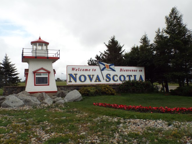
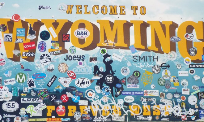
(I’m recapping our recent Nova Scotia trip in words and pictures—lots of pictures. If you’d like to follow along from the beginning, you may want to click here.)
We didn’t know it when we settled in at our Lower Argyle Airbnb, but we’d left Nova Scotia’s South Shore for the Yarmouth and Acadian Shores region of the province. Our first clue came at dinner that night. Another table of patrons included a local couple and their guests, possibly from someplace as far-flung as ours.
In response to a question from one of her visitors, their host said, “It was a shameful moment in our history,” and went on to discuss her admiration for Acadians, noting they are a hard-working group of people who strive to maintain their historical identity. We weren’t exactly eavesdropping, but this foursome’s reunion was ebullient; it was hard not to overhear.
The visitor’s question may have been prompted by the flags flying from so many homes in the area, the same ones that would pepper the landscape on our next day’s travels. It definitely wasn’t the Canadian maple leaf nor the Nova Scotia coat-of-arms flag. This one had vertical bars of blue, white, and red. You might think it was the French flag except for the gold star in its blue third. The Gnome knows flags, but he wasn’t familiar with this one. 


We came upon this interpretive sign and the picturesque Sainte Anne-du-Ruisseau Church near Rocco Point in Argyle. According to the sign, “The main feature of this church is invisible. After the exile and return of the Acadian people, the church provided hope and spiritual renewal. It became the heartbeat of the community—and remains so today.” (I’ll be writing more about the Acadians and their tragic expulsion in the mid-1700s in a later post.)
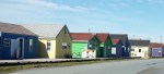
We soon found ourselves in Yarmouth, another colorful town and the port where the big CAT ferry brings people and their cars into Canada from Maine. We spent a couple of hours on a self-guided walking tour—blocks of shipowners’ and sea captains’ homes built in the second half of the eighteen-hundreds.


Downtown Yarmouth


It’s the detail I can’t get over.
The Yarmouth area, home of the world’s richest lobster-fishing grounds, is unsurprisingly also home to Atlantic Canada’s largest fishing fleet. It has suffered its own losses at sea.


The first launching in Yarmouth County took place at this site, now a memorial to the county’s seafaring folks “who ‘going down to the sea in ships,’ by their outstanding seamanship and valour, brought undying honour to Yarmouth in every port around the world” according to the memorial’s plaque.
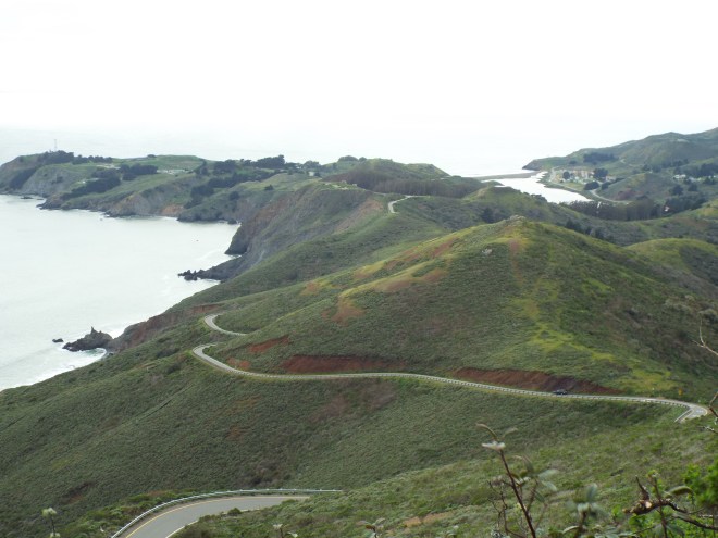
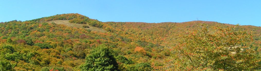
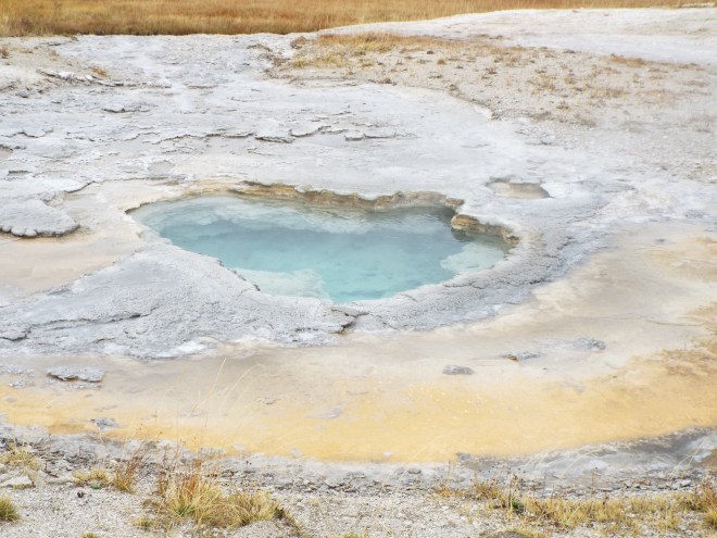
Staff at the Yarmouth visitor center encouraged us to drive out to Cape Forchu, west of Yarmouth. It had been on our list once, but in the interest of time, we’d crossed it off. Back on it went. Cape Forchu, home of the first ‘apple core’ style lighthouse, is surrounded by nineteen acres of beautiful walkable space and has been named one of Canada’s greatest public spaces. I can understand why.


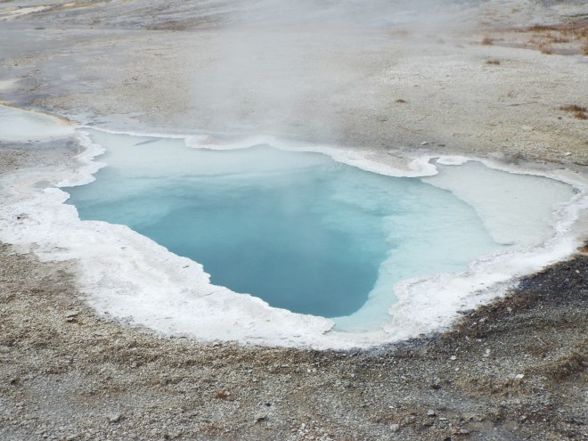
 At Cape Forchu, we learned about rockweed, that stringy, brownish-green stuff you see in this picture. Each fall, fishermen fill their deep-bottomed boats with it using handheld cutter rakes. Rockweed is important to the local economy, exported worldwide where it’s used as a stabilizer and thickener in products as varied as salad dressing, lipstick, and ice cream. Think about that the next time you put a spoonful of your favorite frozen dessert in your mouth.
We also learned about dumping day—probably not what you think. Dumping day occurs at different times in different parts of the province. For southwestern Nova Scotia, it comes on the last Monday in November, the day Southwestern Shore fishermen go out in boats to ‘dump’ their lobster traps. In the wee hours, entire communities line the shore to see them off, a blessing of the fleet is recited, and the brightly lit boats head out to sea in a parade of colorful vessels. Now, that’s something I’d like to see.


After spending a couple of hours at Cape Forchu, we really did have to mark some things off our list to make it to the Annapolis Valley area before nightfall. More about that next time. Hope you’ll keep traveling with me.


 but not before sitting on the deck with a glass of ginger wine and wrapped in quilts (there was a real brr factor that evening) to watch the sun set across the bay.


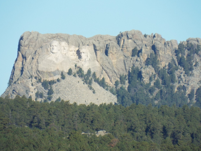
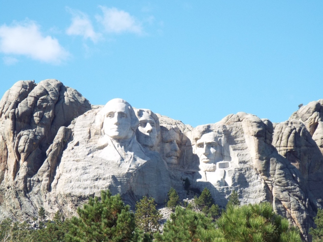


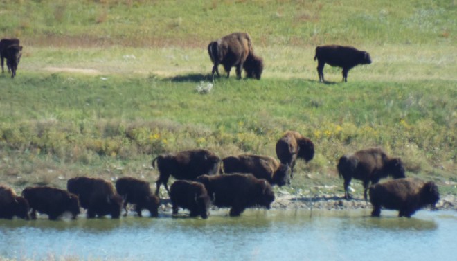
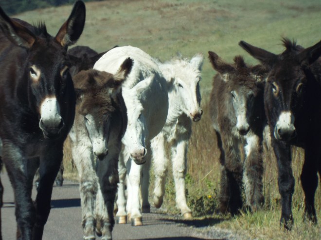
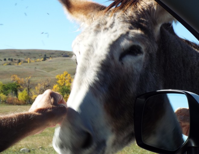
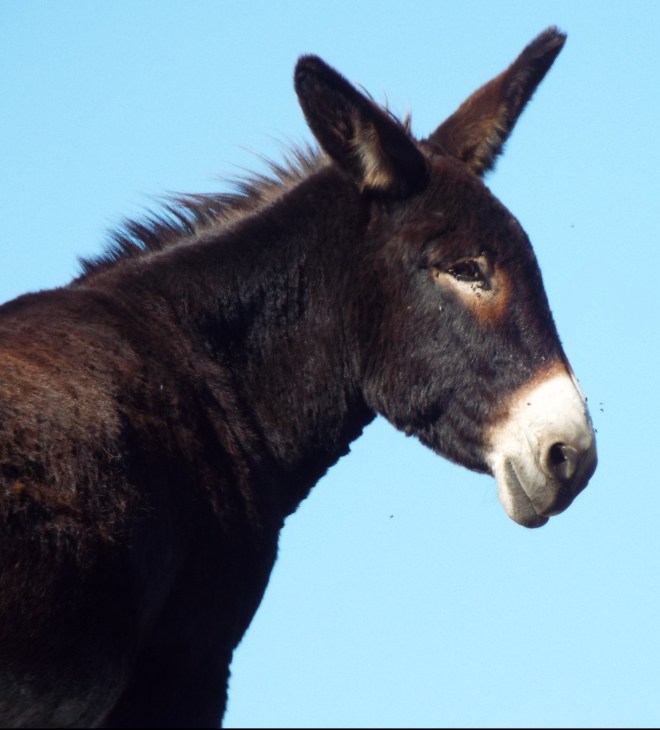
 We really didn’t know what to expect in the Black Hills, other than that we’d see Mount Rushmore and hopefully a few bison or other wildlife blocking our path somewhere or other. Were we ever in for a treat! Driving the Loop Road in Custer State Park, not only did we get close-up (as close as is safe) views of the bison; we got real up close and personal with some pretty brazen donkeys.

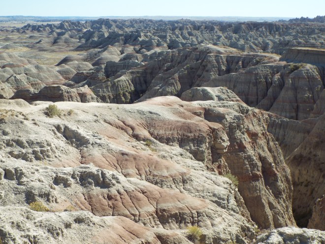
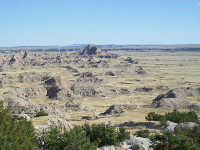
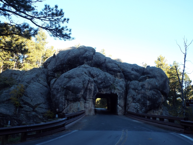
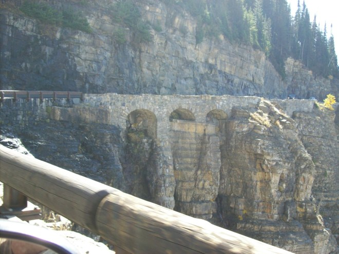
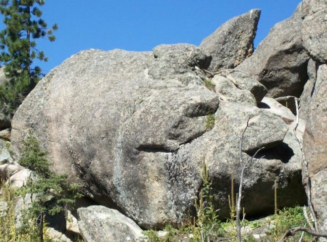
 It was the many unusual and massive rock formations, though, that captured our imagination. Sort of like finding cloud pictures in the sky. We’re definitely returning for a longer stay, probably right smack in Custer State Park. What do you see in these images?


 Leaving our final “cousin destination” in western Montana, we opted for a more southerly route home so we could see more new-to-us parts of the country—a very good idea, it turned out. One of the many unexpected and spectacular sights we encountered was Mt. Borah. Located in the Challis National Forest in eastern Custer County, Mt. Borah is Idaho’s highest mountain. Though it was only rainy down where we were, way up at 12, 667 feet above sea level, snow was beginning to cover the peaks.
 We stopped to learn about the 6.9 magnitude earthquake that shook the mountain in 1983, raising the peak about a foot and lowering the valley floor by eight feet. We could even see the quake’s scar on the side of the mountain. (All very intriguing, but absolutely as close as I ever want to get to an earthquake!)


 We sat on the banks of the Ohio munching on Kingfish Restaurant’s onion rings while the Belle of Louisville graced us with her presence.
 And then there’s Plehn’s Bakery—A Louisville staple for almost a hundred years and one of our favorite weekend destinations back in the day. We couldn’t say goodbye to Louisville without dropping in for our favorite butter kuchen. I wish they shipped!
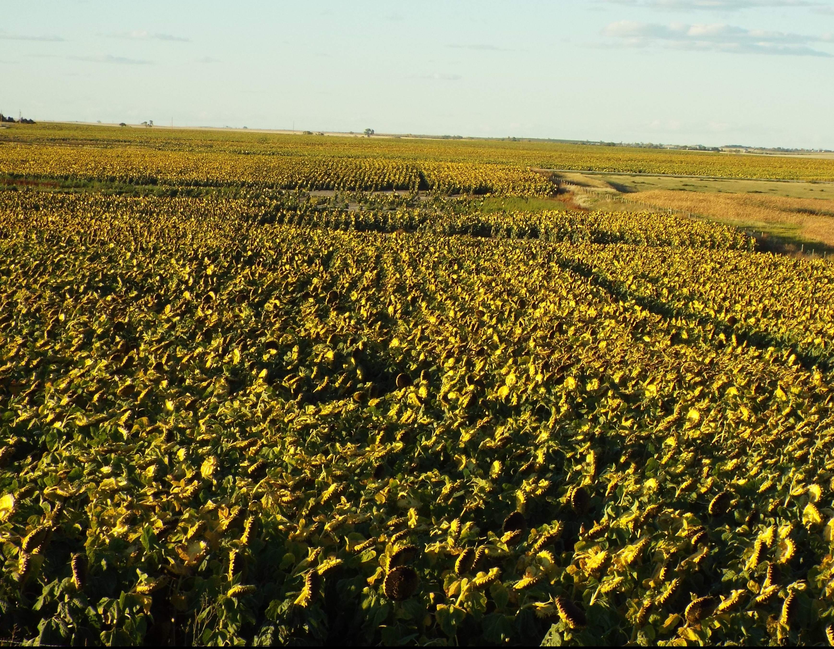
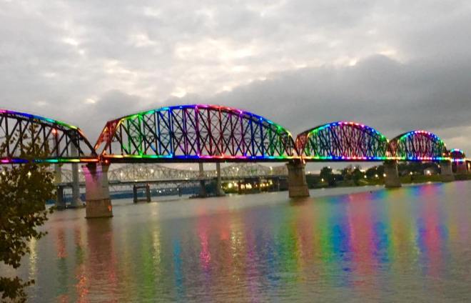 From Louisville we traveled across Indiana and up to northwestern Illinois. We know this route, but the dramatic change from flat plains to rolling hills always catches us off guard. When we visited the museum in charming Galena, we learned a little more about the landscape and its history. The Driftless, an area encompassing parts of Wisconsin, Minnesota, Iowa, and Illinois, escaped the flattening effect of glacial ice fields way back when. As a result, the region is graced with millions of bluffs and valleys with elevation changes of up to 1100 feet. Right in America’s heartland. Driving through the pastoral Driftless is not only beautiful, it’s calming. Good for what ails you.
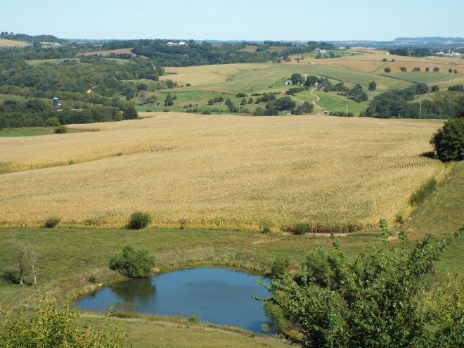 Something we hadn’t seen before in our travels through this area was the silver glint of massive wind farms. Wind turbines filled nearby fields and faded into the distance. Far too many to count. Farther than the eye could see. Watching the blades turn while listening to a classical piece on the car radio nearly put me into a hypnotic trance.
 Of course, we drove past miles and miles of corn. It was higher than the proverbial elephant’s eye. I wondered if any of it was being grown for human consumption.
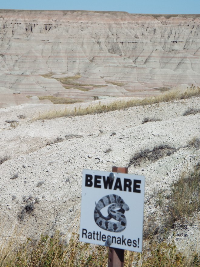 This sign kept us on our toes—especially me with my sandal-exposed tootsies.